
John McCutcheon
John has contributed 23 routes spanning 1,106 miles of routes in California.
Member since April 4, 2019.
10 total upvotes
11 total comments

75 mi
pavement
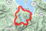
Hartman Bar Ridge LoopPavement route on , Little Grass Valley, Plumas County, California "Nearly all paved, but best ridden on gravel bikes. We only saw very few cars all day. There are several streams to filter water from along this route. There's not much else, so be sure to pack a filter." |

54 mi
gravel
Greenville-Bellas-Rush Cr-Long Valley LoopGravel route on CA-89, Greenville, Plumas County, California "Starts and ends in Greenville. Lots of up and down, on mostly nice roads, but nothing real steep. This route could be shortened to 45 miles by starting at Round Valley Lake." |

49 mi
gravel
Domingo Springs-Wilson Lake-Soldier Meadow LoopGravel route on Willow St, Chester, Plumas County, California "This is an easy ride starting at the park in Chester. The first nine miles to Domingo Spring and the last three miles back into Chester are paved. There's a rough gravel road South of Warner Valley Rd that you could ride if you'd rather avoid pavement." 1 1 |

19 mi
gravel
Almanor Rail Trail-Last Chance Creek LoopGravel route on Willow St, Chester, Plumas County, California "A short loop, starting at the park in Chester, that connects Warner Valley Rd to the 10 Road. After crossing the causeway out of Chester, it follows the Almanor Rail Trail to county road A13, before crossing SR36 and looping up through Last Chance Creek Campground." |

40 mi
gravel
Sloat-Johnsville-Eureka Ridge LoopGravel route on , Cromberg, Plumas County, California "Tiffany and Michelle showed me this very scenic loop. The climb up Jamison Canyon has several rocky sections that would be challenging on a gravel bike, but I was able to pedal through all of them on my hardtail 29er." 1 |

51 mi
gravel
Mt Hough-Twain-Round Valley LoopGravel route on Main St, Taylorsville, Plumas County, California "This is a tough one. The climbs up China and Kingsbury Grades are both about four miles and average around 10%." |

10 mi
gravel
Hungry Creek ConnectorGravel route from Indian Creek Rd to Unnamed Road, Taylorsville, Plumas County, California "Connects Fruit Growers Blvd to the road to Franks Valley." |

11 mi
gravel
Fruit Growers Blvd-Beardsley Grade ConnectorGravel route from Fruit Growers Blvd to Frank's Valley, Taylorsville, Plumas County, California "Nice gravel road connecting Fruit Growers Blvd, below Lone Rock Valley, to Beardsley Grade near Franks Valley. Taylor Lake is only a one mile detour off this route, if you want to stop for a swim." |

94 mi
gravel
Downieville Historical Gravel TourGravel route on Main St, Alleghany, Sierra County, California "Starts and ends in Downieville. About half of this route is paved, but other than the 23 miles of hwy 49, there's not much traffic. Lots of gold mining history to see along the way." 1 |

72 mi
gravel
Diamond Mtn-Bizz Johnson-Moonlight LoopGravel route on Diamond Mountain Rd, Greenville, Plumas County, California "This is a great loop starting at Engel Mine. You could start in Taylorsville, but it would add about 20 miles of pavement to what is already a pretty long ride. After the first big climb up Diamond Mtn, the rest of the ride is pretty mellow. The section between Susanville and Westwood is on the Bizz Johnson Trail, a rails-to-trails trail, so it's very gradual." 3 3 |

59 mi
gravel
Genesee-Red Clover-Walker Mine LoopGravel route on Ward Creek Rd, Taylorsville, Plumas County, California "Only about 12 miles of pavement on this route. Ride up Red Clover Creek to Red Clover Valley, over Crocker Mtn Rd to Lake Davis, and back via Walker Mine. Starting at the Taylorsville Campground would add about 12 miles." 1 |

64 mi
gravel
Red Clover-Antelope Lake LoopGravel route on Beckwourth Genesee Rd, Taylorsville, Plumas County, California "Starts and ends at Heart K Ranch to cut down on pavement. Could start in Taylorsville, but would add about 20 miles of pavement." 1 |
40 mi
gravel
Ohio Valley-Butt Lake-Humbug Valley LoopGravel route on , Plumas County, California "Starts and ends at the boat ramp parking lot at Lake Almanor. A nice loop to connect the Seneca rides to the Jonesville loop. Some of the roads between Butt Lake and Humbug Valley aren't heavily traveled, but there was nothing we couldn't ride through or over. Be sure to stop at the Soda Springs in Humbug Valley for a cold drink." 1 1 |

39 mi
gravel
Keddie-Saddle-Dixie Canyon LoopGravel route on , Taylorsville, Plumas County, California "Starts and ends at the Taylorsville Campground. The climb up Keddie Ridge to Greenville Saddle is long and steady, but not too steep. The climb up Erickson Grade is shorter with only a short steep section near the top. The descent down Dixie Canyon is steep and fast." |

33 mi
gravel
Round Valley-Rush Creek-Long Valley LoopGravel route on Round Valley Rd, Greenville, Plumas County, California "Starts at Round Valley Lake. You could start in Greenville and ride up to and back down from Round Valley via the paved road or Erickson Grade." |

63 mi
gravel
Taylorsville-Westwood-Greenville LoopGravel route on , Taylorsville, California "This route has over 25 miles of pavement, but serves to connect the Indian Valley routes to the Lassen County route near Westwood." |

61 mi
gravel
Lone Rock Valley-Antelope Lake-Beardsley Grade LoopGravel route on , Taylorsville, California "A long, steady climb up to Lone Rock Valley, followed by a short descent to Antelope Lake. Some rollers around the lake and a gradual descent on a fun granite road to Babcock Xing. A steeper climb up Hungry Creek and a steep, rough, fast descent down Beardsley Grade. The ride could be shortened by about 5 miles, and made much easier, by continuing down the paved Antelope Lake Rd from Babcock Xing, and eliminating the Hungry Creel climb." 1 1 |

43 mi
gravel
Keddie Ridge-Moonlight Valley-Diamond Mtn Rd LoopGravel route on , Taylorsville, California "Starts and ends at the Taylorsville Campground. Long, steady climb up Keddie Ridge, but not too steep. Easy ride after that. About 4 miles of pavement at the start and another 12 at the end." |

24 mi
gravel
Moonlight-Diamond Mtn LoopGravel route on Lights Creek Ln, Greenville, Plumas County, California "A short loop starting and ending at the fire station at the end of the North Arm of Indian Valley. It's a long, steady climb up Moonlight Valley Rd, getting steeper for the last mile. Then some rollers through Moonlight Valley, with a nice descent down Lights Creek to Diamond Mtn Rd. You can start in Taylorsville, if you don't mind riding pavement around North Arm, which adds about 8 miles, each way." |

56 mi
gravel
Greenville-Seneca LoopGravel route on , Greenville, Plumas County, California "Starts and ends in Greenville. This is a climby ride, but nothing brutal. Seneca is a great place to stop for a break and enjoy some history." 1 2 |

58 mi
gravel
10 Road to Silver Lake and BeyondGravel route on County Rd 322, Plumas County, California "Starts and ends at the snow park parking lot near the intersection of county road A13 and SR36, East of Chester. This is a moderate ride, with most of the climbing on the paved portion of the 10 road, at the beginning of the ride. After that, it's an easy ride." |

49 mi
gravel
Humbolt-Jonesville-Humbug LoopGravel route on Humbug Humboldt Cross Rd, Chester, Plumas County, California "Starts on the West Shore of Lake Almanor, near Chester. This is a very nice loop that crosses the PCT at two summits, both over 6500' altitude. Jonesville is a nice place to stop for a break and a picture at the old hotel, but there are no services there." 2 |

41 mi
gravel
Taylorsville-Grizzly LoopGravel route on Co Hwy A22, Taylorsville, Plumas County, California "Starts at the Taylorsville Campground, plenty of parking there. Very little pavement on this route, about a mile from the campground to the bottom of China Grade and another six at the end, from Genesee. The climb up China Grade is very steep, with the first two miles of the climb average 13%, with the first four miles averaging 10%." |