
Gone To Plaid
Gone has contributed 160 routes spanning 1,112 miles of routes in Yukon Territory, Virginia, North Carolina and Alaska.
Member since February 19, 2017.
4 total upvotes
11 total comments

2 mi
gravel
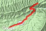
Low Gap Road NorthwestGravel route from Wills Ridge Rd NW to Pkwy Ln S, Floyd, Floyd County, Virginia "The north end of this road connects to SR 730 - Ridgeview Rd. For some reason, Gravelmap doesn't show 730, but Low Gap Rd. does go through." |

1 mi
gravel
Old Anglin Loop to Mayo Beach RoadGravel route from Mayo Beach Rd to Mayo Beach Rd, Stoneville, Rockingham County, North Carolina |

1 mi
gravel
Old Anglin LoopGravel route from Chris Dr to Anglin Mill Rd, Stoneville, Rockingham County, North Carolina |

2 mi
gravel
Gold Field Road NortheastGravel route from Floyd Hwy N to Walnut Ct NE, Check, Floyd County, Virginia |

4 mi
gravel
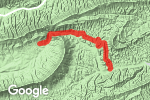
Pugh Mountain RoadGravel route from Co Rd 601 to Pugh Mountain Rd, Sugar Grove, Smyth County, Virginia |

5 mi
gravel
Comers Creek RoadGravel route from S Fork Rd to Appalachian Trail, Sugar Grove, Smyth County, Virginia |

3 mi
gravel
|

9 mi
gravel
Skulls Gap Rd. to Hurricane RoadGravel route from Co Rd 600 to Hurricane Rd, Sugar Grove, Smyth County, Virginia 1 |

4 mi
dirt
Pine Mountain Road (613)Dirt route from Fairwood Rd to Appalachian Trail, Troutdale, Grayson County, Virginia "Rough class 3 road; high clearance recommended. Ends at AT and Scales campground." |

1 mi
gravel
Hereford RoadGravel route from Laurel Fork Rd to Hereford Rd, Laurel Fork, Carroll County, Virginia |

1 mi
gravel
Laurel Fork RoadGravel route on Laurel Fork Rd, Laurel Fork, Carroll County, Virginia |

1 mi
gravel
McLaughlin Road to Vass Mill RoadGravel route from Gladesboro Rd to Excelsior School Rd, Laurel Fork, Carroll County, Virginia "Ford across Big Reed Island creek. Straight across could be 2 feet deep, but it is more shallow crossing 10 feet to the south." 2 |

1 mi
gravel
Countyline Church Road Southeast / Runnett Bag Rd. SEGravel route from Countyline Church Rd SE to State Rte 715, Floyd, Floyd County, Virginia |

2 mi
gravel
Fayerdale DriveGravel route from Fayerdale Dr to Heidelbach School Rd, Stuart, Patrick County, Virginia |

1 mi
dirt
Will Hill Rd.Dirt route from Will Hill Rd to Prillaman Switch Rd, Ferrum, Franklin County, Virginia "Unmaintained county road. Rough class 3 dirt track." |

1 mi
gravel
Will Hill RoadGravel route from Lighthaven Rd to State Rte 771, Ferrum, Franklin County, Virginia |

2 mi
gravel
Carver Lee RoadGravel route from Carver Lee Rd to State Rte 764, Ferrum, Franklin County, Virginia |

2 mi
gravel
Riverbrook Road to River Brook RoadGravel route from State Rte 727 to State Rte 772, Henry, Franklin County, Virginia "Ends at Philpott dam." |

2 mi
gravel
Johnson Hill RoadGravel route on State Rte 894, Henry, Franklin County, Virginia |

2 mi
gravel
Lighthaven RoadGravel route from State Rte 767 to Will Hill Rd, Ferrum, Franklin County, Virginia |

2 mi
gravel
Jacks Mill Road SoutheastGravel route from State Rte 648 to Hummingbird Ln SE, Copper Hill, Floyd County, Virginia |

1 mi
gravel
Bear Ridge Road SoutheastGravel route from Bear Ridge Rd SE to Floyd Hwy N, Copper Hill, Floyd County, Virginia |

1 mi
gravel
Patterson DriveGravel route from Countyline Rd to State Rte 669, Bent Mountain, Roanoke County, Virginia |

1 mi
gravel
Twin Falls Road Northeast to Siner Road NortheastGravel route from Copper Hill Rd NE to Twin Falls Rd NE, Copper Hill, Floyd County, Virginia |

1 mi
gravel
Boone RoadGravel route from Boone Rd to Boners Run, Shawsville, Montgomery County, Virginia "Private road beyond where marked. No access to Willis Hollow Rd." |

2 mi
gravel
Willis Hollow RoadGravel route from Willis Hollow Rd to Alleghany Spring Rd, Shawsville, Montgomery County, Virginia "Private road beyond where marked. No access to Boone Rd." |

0 mi
gravel
Turn for Dam Access Rd.Gravel route on State Rte 710, Pulaski, Pulaski County, Virginia "Class 2 grave to dam, then follows creek south from dam to RR track. Gravelmap base layer does not show these roads." |
3 mi
gravel
State Rte 600Gravel route from Crockett's Cove Rd to State Rte 600, Wytheville, Wythe County, Virginia |
5 mi
gravel
Peak Creek RdGravel route on Peak Creek Rd, Wytheville, Wythe County, Virginia |

4 mi
gravel
VA-613 / N Fork Rd.Gravel route on VA-613, Ripplemead, Giles County, Virginia "Class 2 gravel, shallow and smooth stream crossing around 3 miles in. Class 3+ road possibly continues to WV." |

4 mi
gravel
Rocky Gap Trail / Laurel SpringsGravel route from State Rte 601 to State Rte 601, Newport, Giles County, Virginia "Smooth gravel road." |

4 mi
gravel
State Rte 714 / Little Meadows Rd.Gravel route from Little Meadow Rd to Little Meadow Rd, Ripplemead, Giles County, Virginia "SE end is smooth gravel, gradually gets rougher until quite rutted at NW end." |

2 mi
dirt
State Rte 635 / Stoot's Mountain Rd.Dirt route from McGhee Rd to State Rd 925, Austinville, Carroll County, Virginia "Rougher than many county roads." |

3 mi
dirt
State Rte 635 / Fowler's FerryDirt route from Fowlers Ferry Road to McGhee Rd, Woodlawn, Carroll County, Virginia |

3 mi
dirt
State Rd 202Dirt route on State Rd 202, Pulaski, Pulaski County, Virginia "Forest road, some ruts and potholes." 2 |

7 mi
gravel
State Rte 712 / Millers Creek RdGravel route from Chapman Rd to State Rd 202, Pulaski, Pulaski County, Virginia "Well-maintained gravel road. Sign at southern end says dead-end in 7.5 miles. While the state road does end, a rougher forest road does continue to Gatewood Reservoir." |

4 mi
gravel
Mountain Springs RdGravel route from National Forest Rd 614 to State Rte 625, Ceres, Bland County, Virginia "Very good condition gravel road." |

4 mi
gravel
Smith Hollow Rd. / State Rte 603Gravel route from Smith Hollow Rd to Smith Hollow Rd, Wytheville, Wythe County, Virginia "Maintained gravel road." |

2 mi
gravel
Walker Mountain RdGravel route from Little Creek Rd to Walker Mountain Rd, Dublin, Bland County, Virginia "NF Road, not very maintained. Road is blocked and impassible beyond what is highlighted (as of 2019-05-15)." |

2 mi
gravel
Skydusky Rd. / State Rte 608Gravel route on Skydusky Rd, Bland, Bland County, Virginia "Single lane wood bridge over Walker creek." |

4 mi
gravel
Alum Spring Rd. / State Rte 643Gravel route from Alum Spring Rd to Little Creek Rd, Dublin, Pulaski County, Virginia "Gravel to dirt over the hill. Some ruts and washes. Lookout near top, looking to South." |

1 mi
gravel
Bell Branch RdGravel route from Longbottom Rd to Boundary Line Rd, Hays, Wilkes County, North Carolina "Thurmond Chatham Wildlife Management Area. Gravel 2-track, some areas are gated." |

5 mi
gravel
Old North Carolina 16 S / Old Wilkes Rd.Gravel route from Trading Post Rd to Old North Carolina 16, Millers Creek, Wilkes County, North Carolina |

4 mi
gravel
Sheets Gap RdGravel route from Sheets Gap Rd to Buckwheat Branch Rd, Laurel Springs, Wilkes County, North Carolina |

2 mi
gravel
State Rte 635 / Countyline church Rd.Gravel route on Countyline Church Rd SE, Floyd, Floyd County, Virginia |

1 mi
gravel
Short Cut Rd.Gravel route from Woods Gap Rd to Short Cut Rd, Woolwine, Patrick County, Virginia |

1 mi
gravel
State Rte 664 / Silverleaf Rd.Gravel route from State Rd 660 to Silver Leaf Rd, Dugspur, Carroll County, Virginia |

1 mi
gravel
Fairhaven RdGravel route from Burkes Ford Rd to State Rd 660, Dugspur, Carroll County, Virginia |

3 mi
gravel
Burkes Ford RdGravel route from Burkes Ford Rd to State Rd 628, Dugspur, Carroll County, Virginia |

2 mi
gravel
State Rd 624Gravel route from Dugspur Rd to Poplar Hill Dr, Dugspur, Carroll County, Virginia |

3 mi
gravel
Newmantown RdGravel route from Dugspur Rd to State Rd 624, Dugspur, Carroll County, Virginia |

3 mi
gravel
State Rte 638 / Huff Hill Rd.Gravel route from Hunters Ridge Rd to New Hope Rd, Dugspur, Carroll County, Virginia |

1 mi
gravel
Waterview DrGravel route from Hunters Ridge Rd to Double Cabin Rd, Hillsville, Carroll County, Virginia |

1 mi
gravel
|

1 mi
gravel
Lindsey Mill RdGravel route from Lindsey Mill Rd to Ocala Rd, Dugspur, Carroll County, Virginia |

4 mi
gravel
Sutphintown RdGravel route from State Rd 761 to State Rd 765, Dugspur, Carroll County, Virginia |

6 mi
gravel
Walker Mountain RdGravel route from Walker Mountain Road to Walker Mountain Rd, Bland, Bland County, Virginia 1 1 |

8 mi
gravel
Wyrick TrailGravel route from Forest Spur Dr to N Scenic Hwy, Bland, Bland County, Virginia "Good condition gravel rd." |

13 mi
dirt
Hogback Ridge Rd / FR 640Dirt route from N Scenic Hwy to Unnamed Road, Bland, Bland County, Virginia "Rough dirt road. Many very deep mud puddles." 1 |

11 mi
dirt
FR 201 - Dismal Creek Rd to Flat Top Mt Tower RdDirt route from State Rte 671 to Flat Top Mount Tower Road, Pearisburg, Giles County, Virginia "Fair condition. West end to Walnut Flats camp is good gravel. Further West is passable by big ADV, but rough in many places." |

8 mi
gravel
|

1 mi
gravel
State Rte 795Gravel route from State Rte 795 to Concord Rd, Meadows of Dan, Patrick County, Virginia |

0 mi
gravel
Burkes Hollow Rd SWGravel route on Burkes Hollow Rd SW, Willis, Floyd County, Virginia |

2 mi
gravel
State Rte 812Gravel route from Showalter Rd NW to State Rte 812, Indian Valley, Floyd County, Virginia |

1 mi
gravel
State Rte 753Gravel route from Indian Creek Rd NW to State Rte 753, Willis, Floyd County, Virginia |

2 mi
gravel
State Rte 605Gravel route on State Rte 605, Floyd, Floyd County, Virginia |

1 mi
gravel
Parkway Church Rd SWGravel route on Parkway Church Rd SW, Meadows of Dan, Floyd County, Virginia "Gets rougher at south end. Continues to Fork Mtn. Rd." |

2 mi
gravel
State Rte 603Gravel route on Fork Mountain Rd SW, Meadows of Dan, Floyd County, Virginia |

1 mi
gravel
State Rte 785Gravel route from Burks Fork Rd SW to State Rte 785, Willis, Floyd County, Virginia |

0 mi
gravel
State Rte 786Gravel route on State Rte 786, Willis, Floyd County, Virginia |

4 mi
gravel
State Rte 784 to State Rte 785Gravel route from State Rte 784 to Hylton Hollow Rd SW, Willis, Floyd County, Virginia |

4 mi
gravel
State Rte 630Gravel route from State Rte 786 to State Rte 630, Willis, Floyd County, Virginia |

2 mi
gravel
State Rte 786Gravel route from Boone Rd SW to State Rte 786, Willis, Floyd County, Virginia |

1 mi
gravel
State Rte 783Gravel route on State Rte 783, Willis, Floyd County, Virginia |

1 mi
gravel
State Rte 783Gravel route from Thistle Hill Rd SW to State Rte 783, Willis, Floyd County, Virginia |

1 mi
gravel
State Rte 749Gravel route from State Rte 749 to Rocky Hill Rd NW, Willis, Floyd County, Virginia |

3 mi
gravel
State Rte 765 to State Rte 764Gravel route from State Rte 765 to Merifield Rd NW, Willis, Floyd County, Virginia |

2 mi
gravel
State Rte 764Gravel route on State Rte 764, Willis, Floyd County, Virginia |

2 mi
gravel
State Rte 763 / Deer Valley Rd.Gravel route on State Rte 763, Willis, Floyd County, Virginia |

2 mi
gravel
State Rte 652Gravel route from Gardner Rd NW to State Rte 762, Willis, Floyd County, Virginia |

7 mi
gravel
State Rte 619 to State Rte 613Gravel route from Windy Ridge Rd NW to State Rte 613, Indian Valley, Floyd County, Virginia "Easy ford on Berry Creek Rd." |

3 mi
gravel
State Rte 760 / Quesenberry Rd.Gravel route from State Rte 760 to Quesenberry Rd NW, Willis, Floyd County, Virginia |

1 mi
gravel
State Rte 760 / Windsor Rd.Gravel route on State Rte 760, Willis, Floyd County, Virginia |

3 mi
gravel
State Rte 771Gravel route from State Rte 771 to State Rte 771, Willis, Floyd County, Virginia |

2 mi
gravel
State Rte 740 / Indigo Mtn. Rd.Gravel route from State Rte 740 to State Rte 740, Floyd, Floyd County, Virginia |

2 mi
gravel
State Rte 728Gravel route from Wade Rd NW to Ferney Creek Rd NW, Willis, Floyd County, Virginia |

2 mi
gravel
State Rte 743 / Reedsville Rd.Gravel route from State Rte 743 to State Rte 728, Floyd, Floyd County, Virginia |

1 mi
gravel
State Rte 740 / Weeks Rd.Gravel route on State Rte 740, Floyd, Floyd County, Virginia |

4 mi
gravel
State Rte 631 / Sawmill Hill Rd.Gravel route from State Rte 631 to Sawmill Hill Rd NW, Willis, Floyd County, Virginia |

2 mi
gravel
State Rte 631 / Duncan Valley Rd.Gravel route from State Rte 631 to State Rte 631, Radford, Floyd County, Virginia "Ford across Little Indian Creek" |

1 mi
gravel
State Rte 601Gravel route from River Hill Rd to State Rte 601, Riner, Floyd County, Virginia |

4 mi
gravel
State Rte 739 to State Rte 737 / Reed Hill Rd.Gravel route from Reed Hill Rd NW to State Rte 738, Floyd, Floyd County, Virginia |

2 mi
gravel
State Rte 738Gravel route from State Rte 738 to State Rte 738, Riner, Floyd County, Virginia |

2 mi
gravel
State Rte 716 / Little Camp Rd.Gravel route from Homestead Rd to State Rte 716, Riner, Montgomery County, Virginia |

2 mi
gravel
State Rte 617 / Brush Creek Rd.Gravel route on Brush Creek Rd, Riner, Montgomery County, Virginia |

1 mi
gravel
Sowers Mill Dam Rd NEGravel route on Sowers Mill Dam Rd NE, Riner, Floyd County, Virginia "At end of road, there is a breached dam and gristmill foundations." |

1 mi
gravel
State Rte 601 / Clarence Rd.Gravel route on State Rte 601, Riner, Montgomery County, Virginia |

1 mi
gravel
State Rte 616 / Otey Rd.Gravel route from State Rte 616 to Otey Rd NE, Riner, Floyd County, Virginia |

1 mi
gravel
|

3 mi
gravel
State Rte 706 / Thunderstruck Rd.Gravel route on State Rte 706, Floyd, Floyd County, Virginia "Follows the Little River" |

1 mi
gravel
State Rte 699Gravel route on State Rte 699, Floyd, Floyd County, Virginia |

4 mi
dirt
Gator Mountain Rd to Fall Branch TrailDirt route from Gator Mountain Rd to Fall Branch Trail, Indian Valley, Carroll County, Virginia "Rough road - stream crossings, narrow." |

3 mi
gravel
|

1 mi
gravel
State Rte 672Gravel route on State Rte 672, Pilot, Floyd County, Virginia |

2 mi
gravel
State Rte 614 / Lovell Rd.Gravel route on State Rte 614, Pilot, Montgomery County, Virginia |

2 mi
gravel
State Rte 726 / Gold Rush Rd.Gravel route on State Rte 726, Pilot, Montgomery County, Virginia |

1 mi
gravel
State Rte 682 / Spangler Mill Rd.Gravel route from Spangler Mill Rd NE to State Rte 682, Floyd, Floyd County, Virginia |

1 mi
gravel
State Rte 682 / Harvestwood Rd.Gravel route on State Rte 682, Floyd, Floyd County, Virginia |

3 mi
gravel
State Rte 706 / Thunderstruck Rd.Gravel route from State Rte 706 to Thunderstruck Rd NE, Floyd, Floyd County, Virginia "Follows the Little River - scenic." |

3 mi
dirt
E. Road from Burke's GardenDirt route from State Rte 666 to Round Mountain Rd, Bastian, Bland County, Virginia 1 |

219 mi
gravel
AK-11 N/N Slope Haul Rd / Dalton Hwy.Gravel route from AK-11 to Airport Way, Prudhoe Bay, North Slope, Alaska 1 |

90 mi
gravel
AK-11 S/N Slope Haul Rd / Dalton Hwy.Gravel route from Dalton Hwy to AK-11, Fairbanks, Yukon-Koyukuk, Alaska 1 |

443 mi
gravel
Dempster Hwy/YT-5 NGravel route from YT-5 to NT-8, Inuvik, Inuvik Region, Northwest Territories "Maintained Gravel Rd. As of July 2014, Fuel was at: Southern end (40 km E. of Dawson City) Eagle Plains Fort McPherson Inuvik" |

1 mi
gravel
Flatwood RdGravel route on Flatwood Rd, Dugspur, Carroll County, Virginia |

1 mi
gravel
Deer Trail RdGravel route on Deer Trail Rd, Dugspur, Carroll County, Virginia |

1 mi
gravel
State Rte 710 / Wood's GapGravel route from State Rte 710 to Woods Gap Rd SE, Floyd, Floyd County, Virginia |

3 mi
gravel
State Rte 605 / Fairview Church / Happy TrailsGravel route on State Rte 605, Floyd, Floyd County, Virginia |

1 mi
gravel
State Rte 724 / Old Furnace Rd.Gravel route on State Rte 724, Floyd, Floyd County, Virginia |

2 mi
gravel
State Rte 714 / Spring Dale Rd.Gravel route on State Rte 714, Floyd, Floyd County, Virginia |

4 mi
gravel
State Rte 709 / Morning Dew LnGravel route on State Rte 709, Floyd, Floyd County, Virginia |

0 mi
gravel
State Rte 637 / Chestnut Ln.Gravel route on State Rte 637, Floyd, Floyd County, Virginia |

3 mi
gravel
State Rte 635 to State Rte 637 / Thomas Farm Rd.Gravel route from Thomas Farm Rd SE to State Rte 637, Floyd, Floyd County, Virginia |

1 mi
gravel
State Rte 680 / Starbuck Rd.Gravel route on State Rte 680, Floyd, Floyd County, Virginia |

2 mi
gravel
State Rte 793 / Cannaday's Gap Rd.Gravel route on State Rte 793, Floyd, Floyd County, Virginia |

2 mi
gravel
State Rte 793 / Runnett Bag Rd.Gravel route from State Rte 793 to State Rte 793, Floyd, Floyd County, Virginia 1 |

2 mi
gravel
State Rte 637 / Griffith Hill Rd.Gravel route on Griffith Hill Rd, Ferrum, Franklin County, Virginia |

1 mi
gravel
State Rte 865 / Timber Line Rd.Gravel route from State Rte 865 to Timber Line Rd, Ferrum, Franklin County, Virginia |

1 mi
gravel
State Rte 865 / Timber Line Rd.Gravel route from Timber Line Rd to State Rte 865, Ferrum, Franklin County, Virginia |

1 mi
gravel
State Rte 865 / Timber Line Rd.Gravel route from State Rte 865 to Timber Line Rd, Ferrum, Franklin County, Virginia |

4 mi
gravel
State Rte 622 / Deer Run Rd. / St. John's Loop Rd.Gravel route from Deer Run Rd to State Rte 622, Ferrum, Franklin County, Virginia |

1 mi
gravel
Buffalo RdGravel route on State Rd 1680, Madison, Stokes County, North Carolina |

4 mi
gravel
Dust Trail RdGravel route from Dust Trail Rd to Laurel Fork Rd, Laurel Fork, Carroll County, Virginia |

1 mi
gravel
Philpott RdGravel route on Philpott Rd, Stoneville, Rockingham County, North Carolina |

2 mi
gravel
State Rte 716 / Tuggles Gap Rd SWGravel route from State Rte 716 to Tuggles Gap Rd SW, Floyd, Floyd County, Virginia |

5 mi
gravel
State Rte 655 / Sumpter Rd. / Higgs Rd.Gravel route on State Rte 655, Willis, Floyd County, Virginia |

7 mi
gravel
Rock Creek Rd / Panther Creek Rd.Gravel route from Panther Creek Rd to Rock Creek Rd, Allisonia, Pulaski County, Virginia 1 1 |

7 mi
gravel
State Rte 611 / Macks Mountain Rd / Deepwater RdGravel route from State Rte 611 to State Rte 611, Dugspur, Carroll County, Virginia |

1 mi
gravel
Independence RdGravel route on Independence Rd, Sparta, Alleghany County, North Carolina |

0 mi
gravel
Thornton RdGravel route on Thornton Rd, Mayodan, Rockingham County, North Carolina |

0 mi
gravel
Pruitt RdGravel route on Pruitt Rd, Stoneville, Rockingham County, North Carolina |

1 mi
gravel
Victory Hill Church RdGravel route from Victory Hill Church Rd to State Rd 1352, Mayodan, Rockingham County, North Carolina |

1 mi
gravel
Goins School RdGravel route from Goins School Rd to Goins School Rd, Stoneville, Rockingham County, North Carolina |

2 mi
gravel
State Rte 605Gravel route from State Rte 605 to Fire Rd U S Park Service, Woolwine, Patrick County, Virginia "State road is marked. Foot / bicycle trail continues West." |

1 mi
gravel
Percy Moorefield RdGravel route on Percy Moorefield Rd, Danbury, Stokes County, North Carolina |

2 mi
gravel
Haystack RdGravel route from Haystack Rd to State Rd 1328, Dobson, Surry County, North Carolina |

1 mi
dirt
Trot Valley / Rye CoveDirt route from State Rte 815 to State Rte 640, Stuart, Patrick County, Virginia "Rough, un-maintained 2-track" |

1 mi
dirt
State Rte 815 / Rye Cove Rd.Dirt route on State Rte 815, Claudville, Patrick County, Virginia "Rough, un-maintained 2-track" |

1 mi
gravel
Paw Paw RdGravel route from Paw Paw Rd to State Rd 1377, Stoneville, Rockingham County, North Carolina |

0 mi
gravel
Oakley RdGravel route on Oakley Rd, Stoneville, Rockingham County, North Carolina |

2 mi
gravel
State Rte 628 / Dick and Willie Rd.Gravel route from State Rte 628 to State Rte 628, Critz, Patrick County, Virginia |

1 mi
gravel
Jesse Knight RdGravel route on Jesse Knight Rd, Sandy Ridge, Stokes County, North Carolina |

1 mi
gravel
Hope Beasley RdGravel route on Hope Beasley Rd, Sandy Ridge, Stokes County, North Carolina |

1 mi
gravel
State Rte 656 / Corns Rd.Gravel route on State Rte 656, Stuart, Patrick County, Virginia |

1 mi
gravel
State Rte 690/Taylor View RdGravel route on State Rte 690, Patrick Springs, Patrick County, Virginia |

1 mi
gravel
Open Meadow RdGravel route on State Rte 690, Patrick Springs, Patrick County, Virginia "Great scenery of mountains and pastures." |

1 mi
gravel
State Rte 689/Vfw RdGravel route on State Rte 689, Patrick Springs, Patrick County, Virginia "Great scenery of mountains and pastures." |

5 mi
gravel
State Rte 687 - Bull Mountain Rd.Gravel route on State Rte 687, Patrick Springs, Patrick County, Virginia "Great scenery of mountains and pastures." |

1 mi
gravel
State Rte 687 to Tudor Orchard RdGravel route on State Rte 687, Stuart, Patrick County, Virginia |

1 mi
gravel
State Rte 735Gravel route on State Rte 735, Ararat, Patrick County, Virginia |

1 mi
gravel
State Rte 767Gravel route on State Rte 767, Ararat, Patrick County, Virginia |