
Washagorider1
Washagorider1 has contributed 57 routes spanning 484 miles of routes in Quebec, Ontario and .
Member since September 9, 2020.
1 total upvotes
4 total comments

9 mi
gravel
Log Rd to Pickerel RiverGravel route from , Pakesley to , French River, Sudbury District, Ontario |

1 mi
gravel
Sunset Pass RoadGravel route from Sunset Passage Dr to So Ho Mish Rd, Katrine, Parry Sound District, Ontario |

6 mi
gravel
Rain Lake Road/Cripple Creek roadGravel route from Rain Lake Rd to Rain Lake Rd, Kearney, Parry Sound District, Ontario "One way in/out, with off shot options to explore " |

12 mi
gravel
|

26 mi
gravel
abandoned rail lineGravel route from ON-539A to Riding Stable Rd, North Bay, Nipissing District, Ontario "original rail bed stone, some sandy spots, and whoops, gas in River Valley 2021" |

7 mi
gravel
abandoned rail lineGravel route from ON-539A to ON-539A, Glen Afton, Nipissing District, Ontario "gas was available in River Valley on line 2021. Original rail bed stone, " |

8 mi
gravel
Weyerhauser rdGravel route from , Tomiko to , Eldee, Nipissing District, Ontario |

8 mi
gravel
|

8 mi
gravel
Sand Dam Road, Tomoko Rail stationGravel route from , North Bay to , Tomiko, Nipissing District, Ontario "to abandoned rail yard buildings" |
3 mi
gravel
|
4 mi
gravel
|
3 mi
gravel
|

4 mi
gravel
Hwy 64/Island lake rd , dryer north sectionGravel route on , Désaulniers, Nipissing District, Ontario |

10 mi
gravel
Gibbons rd to Saint Joseph Road, River ValleyGravel route from ON-539A to ON-539A, West Nipissing, Nipissing District, Ontario |

14 mi
gravel
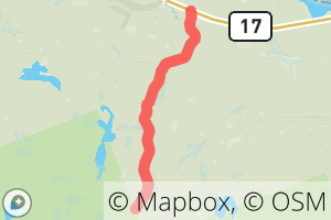
Highway 535; Abandoned Rail to Hager(17)Gravel route from Trans-Canada Hwy to Trans-Canada Hwy, Hagar, Sudbury District, Ontario |

15 mi
gravel
Abandoned Rail LineGravel route on , Markstay-Warren, Sudbury District, Ontario "Original rail bed, some wash out sections and Large trestle south of Wanapitaie lake I would go over on ADV bike , poor condition and very high. " |

2 mi
gravel
Orange bridge over Sturgeon River, log road.Gravel route on , Glen Afton, Nipissing District, Ontario |

4 mi
gravel
Abandoned rail line, original rail line rock base, atv-adv bikeGravel route from , Glen Afton to , Markstay-Warren, Sudbury District, Ontario "Couple of off shoots north south on gravel roads, old trestles and bridges in place , but use caution! " |
2 mi
gravel
|

15 mi
gravel
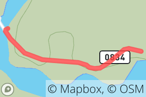
to R0834Gravel route from , Depot-Rowanton to , Depot-Rowanton, Quebec |
0 mi
gravel
R0834Gravel route on |
7 mi
gravel
ZEC RestigoGravel route on |
42 mi
gravel
Chemin de ManiwakiGravel route from Chem. de Maniwaki to Chem. de Maniwaki, Témiscaming |

16 mi
gravel
|

27 mi
gravel
Chiswick Line to Peddlers DriveGravel route from Kells Rd to Peddlers Dr, Eau Claire, Nipissing District, Ontario |

9 mi
gravel
Mackay RoadGravel route from Montreal River Rd to Unnamed Road, Montreal River, Algoma District, Ontario |

11 mi
gravel
Mile 67 road Rebecca’s roadGravel route from Unnamed Road to Unnamed Road, Montreal River, Algoma District, Ontario |

10 mi
gravel
Pipe Lake RoadGravel route on Unnamed Road, Batchawana Bay, Algoma District, Ontario |

13 mi
gravel
Carp Lake RoadGravel route from ON-17 to Unnamed Road, Batchawana Bay, Algoma District, Ontario "Gravel forest access road. Rider on Honda CB500x Adventure bike, x3 culverts washed out but dips in road passable in dry conditions. No cell service, saw 2 other atv users in trip, Heavy Bear usage of road with dozens of scat and couple sightings " |

34 mi
gravel
Highway 546Gravel route from ON-546 to ON-129, Bruce Mines, Algoma District, Ontario "Gravel road, good shape, " 1 |
11 mi
gravel
Bissett Creek RoadGravel route on Bissett Creek Rd, Renfrew County, Ontario "Gravel, to Park Boundaries " |

2 mi
gravel
Wagon rd to campsGravel route on Old Wagon Rd, Baysville, Muskoka District Municipality, Ontario |

7 mi
gravel
Black River RoadGravel route on Black River Rd, Bracebridge, Muskoka District Municipality, Ontario |

3 mi
gravel
Black River RoadGravel route from Pine Springs Rd to Pine Springs Rd, Bracebridge, Haliburton County, Ontario |

5 mi
gravel
Pine Springs RoadGravel route on Pine Springs Rd, Bracebridge, Haliburton County, Ontario |

8 mi
gravel
Sherborne Lake Access RoadGravel route on Sherborne Rd, Minden, Haliburton County, Ontario "Access road , passes threw crown land north of the Frost Centre, many canoe routes and camp opportunities " |

1 mi
gravel
Cell tower road - Edmond Fitzgerald Look outGravel route from Lookout Trail Rd to Unnamed Road, Batchawana Bay, Algoma District, Ontario "Atv trail access to right going up to lookout trail. Before tower at top." |

2 mi
gravel
Edmond Fitzgerald Hiking, Mtn bike- gravel bikeGravel route on Smiths Rd, Batchawana Bay, Algoma District, Ontario "Some hike a bike rough sections appx 400 m close to look out, several dozen stairs to look out platforms " |

1 mi
gravel
Voyager Lodge RdGravel route from Unnamed Road to ON-17, Batchawana Bay, Algoma District, Ontario |

3 mi
gravel
Tribeg - Voyager Lodge rdGravel route on Unnamed Road, Batchawana Bay, Algoma District, Ontario |

4 mi
gravel
Tribeg Rd - Batchawana FallsGravel route on Unnamed Road, Batchawana Bay, Algoma District, Ontario 1 |

4 mi
gravel
Tribeg amine rdGravel route from ON-17 to Unnamed Road, Batchawana Bay, Algoma District, Ontario "2.5 km Hwy 17 paved shoulder " |

4 mi
gravel
Highway 563 to 17Gravel route from ON-563 to ON-17, Batchawana Bay, Algoma District, Ontario "Atv trail Beside 17 , on semi paved 563 " |

3 mi
gravel
Center Batchawana PeninsulaGravel route from Maple Ridge Rd to Superior St, Batchawana Bay, Algoma District, Ontario "Maple ridge to Superior Look Out rd" |

3 mi
gravel
Smiths rdGravel route from Unnamed Road to Smiths Rd, Batchawana Bay, Algoma District, Ontario "Smiths road to Pancake Bay lookout trail net work , Atv trail off shoulder beside hwy17, through abandoned gravel pit Hwy 17 south to Maple a Ridge road" |

3 mi
gravel
Highway 563 to Maple Ridge RoadGravel route from ON-563 to Unnamed Road, Batchawana Bay, Algoma District, Ontario |

1 mi
gravel
Old Railway Bike Trail- Two RiversStore - Old Railway main trailGravel route on Old Railway Bike Trail, Sproule Township, Nipissing District, Ontario |
10 mi
gravel
Old Railway Bike Trail; Track and Tower Trail , trail from Westernmost to EasternmostGravel route from Track and Tower Trail to Rock Lake Rd, Nipissing District, Ontario |

7 mi
gravel
Red Squirrel Road , Gate to Sharp Rock Islet Bridge/ Portage ( *gate closed to MOTORIZED access)Gravel route from Red Squirrel Rd to Unnamed Road, Temagami, Nipissing District, Ontario |

1 mi
gravel
Wanipetaie Lodge , Sandy Inlet access, canoe trip parking lotGravel route from Red Squirrel Rd to Unnamed Road, Temagami, Nipissing District, Ontario "Access to camping on sand beach Lake Temagami " |

9 mi
gravel
Seguin Trail / Park to Park Trail to Main Street Fernglen rd/KearnyGravel route from Whitney Rd to Main St, Kearney, Parry Sound District, Ontario 1 |

8 mi
gravel
Park to Park Trail to Seguin Trail / Park to Park Sprucedale/FernglenGravel route from ON-518 to Whitney Rd, Emsdale, Parry Sound District, Ontario |

14 mi
gravel
Chain Of Lakes Road to Park to Park Trail, SprucedaleGravel route from Chain of Lakes Rd to Regional Road 518, Sprucedale, Parry Sound District, Ontario |
8 mi
gravel
Seguin Trail / Park-to-Park Trail to Sequin Trail / Park-to-Park TrailGravel route from Tally Ho-Swords Rd to Chain of Lakes Rd, Parry Sound, Parry Sound District, Ontario |
7 mi
gravel
Highway 11 to Seguin Trail / Park-to-Park TrailGravel route on Seguin Trail, Parry Sound, Parry Sound District, Ontario 1 |

19 mi
gravel
Red Squirrel RoadGravel route on Red Squirrel Rd, Temagami, Nipissing District, Ontario "Red Squirrel Road to Sandy Inlet bay, Lake Temagami " |

9 mi
gravel
Carlyon Line to Swift Rapids RoadGravel route from Carlyon Line to Swift Rapids Rd, Coldwater, Simcoe County, Ontario "Gravel access road to Swift Rapids dam and Trent Lock 43. Single lane gravel road, used by pick ups etc to camp halfway in, atvs to go on mud bog trails . Appx 29 km in and out and 390 m climb on gradual rolling terrain. Some wildlife viewing opportunities " |