Outer Limits An Adventure Is Waiting On Two Wheels
Outer has contributed 10 routes spanning 255 miles of routes in British Columbia.
Member since April 20, 2023.
2 total upvotes
4 total comments

13 mi
gravel
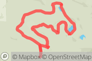
Spruceton Gravel Short Figure 8Gravel route on Spruston Rd, Nanaimo, Nanaimo, British Columbia |

11 mi
gravel
Spruceton Rd To Haslam Creek Cabin Circular Route,Gravel route on Spruston Rd, Nanaimo, British Columbia "A great exploratory route, this whole area has so much to offer and can be made much longer or do several shorter routes. This Particular route starts out at the end of the pavement on Spructon Rd. Park in the opening to the start of The White Pines Trail. Start riding on a paved section (about 50 meters long give or take) to the right of the trail. The road takes you out by two lakes the first on your right being McKay Lake then a little later Crystal Lake. There are a few cross ditches along the way, most notably at the very end while passing the second lake, a loose hike a bike section to the right. From here for a short bit you will be on an active logging rd. for a few minutes before heading back onto old double track, Most of these have become Horse trails, although I've only run into a few through the years, Watch for the signs on the trees, It goes as follows: Crystal Lake to Buddy to To Teaka to Teddy J To Denver To Right on Sierra and left on Cabin Trail. You will come to a steep hill at the end. I usually leave my bike here as its really steep with a creek crossing on both sides. The cabin is fairly close, I've brought my bike a few times but unless I'm continuing on the other side its not worth it. After your visit return the way you came on the Cabin Trail and turn left on Sierra, follow until you hit McKay Lake Forest service rd. back to parking." |

59 mi
gravel
Tour De HumpGravel route on Sixth St, Nanaimo, Nanaimo, British Columbia "This route is not all Gravel, Starts on Pavement and ends on Pavement. Most of the middle section is on Gravel. Surface type is as Marked on Map. But a fun route with some great views and some fast cruzy sections." |

12 mi
gravel
The North Fork of The Nanaimo River Short Loop.Gravel route on , Nanaimo, Nanaimo, British Columbia "A great route with a relaxing start ascending to a few short steeper climbs to a nice rolling traverse below Blackjack Ridge down to a steep fun descent. A lot of fun, future lengths will be posted soon. " |

28 mi
gravel
Barsby Lake LoopGravel route on Wakesiah Ave, Nanaimo, Nanaimo, British Columbia "Leaving from the North entrance into the Colliery Dam Park, About 50m in branch left on to easy single track that follows the left side of Nanaimo Lakes Rd. heading South west. passing both lakes on your left. The trail connects to pavement just below the Parkway overpass and continues on pavement for a short few kms As you proceed on Nanaimo Lakes Rd. Watch for a recently installed yellow gate on your left and branch onto this Gravel rd. From here on you will be mostly on Gravel rds. with two shorter sections of Pavement. A nice fun route with a few muddy spots but pretty clean for the most part and some nice views. " 1 |

15 mi
gravel
Nanaimo Lakes Road Weigles RdGravel route from S Forks Rd to Weigles Rd, Nanaimo, Nanaimo, British Columbia "One of the most common Gravel rides "142 Main" takes you out behind Mt. Benson and Wolf Mtn. in the Nanaimo Area. It can be done in either direction, Its a bit steeper from the Nanaimo Lakes rd. start. Quite scenic in an "Active" logging sort of way. A few nice lakes in the area, gives you lots of options for several other loops etc. Great area to explore." |

29 mi
gravel
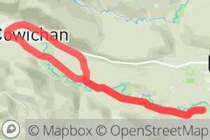
Glenora to Lake Cowichan South side to North Side (Half Loop)Gravel route on , Cowichan Valley, British Columbia "Mostly all Gravel with the exception of the crossover at Lake Cowichan from the South side to the North side and the crossover back on Mayo rd. from the North side to the South side. A very easy going rail trail, usually well maintained, the south side up from Glenora is a little more scenic (albeit a little rougher surface) as well as where all the trestles are located. The North side probably sees more traffic from my experience and is quite a nice ride as well and easy going. Both sides have seen some sink holes over the years which can result in temporary closures or ride arounds." 1 |

41 mi
gravel
Windy point campsite return via Nanaimo Lakes rd. and Barsby LakeGravel route on Wakesiah Ave, Nanaimo, Nanaimo, British Columbia |

28 mi
gravel
Mount Benson Circumnavigation "Nanaimo Lakes Road to Parkway Trail"Gravel route on Wakesiah Ave, Nanaimo, Nanaimo, British Columbia "A fairly popular route that gets you out behind Mount Benson, The main rd. #142 gives you access to many other routes and possibilities. Depending where you start and finish, whether it be Nanaimo Lakes Rd. or Doumont rd. both directions are great options." 1 1 |

18 mi
gravel
The Three Lakes TourGravel route on Spruston Rd, Nanaimo, Nanaimo, British Columbia "Starts at Haslam Creek Crossing on Spruceton rd. Cross the foot bridge on Haslam cr. and follow the route on pavement through Cassidy up towards Rondalyn Resort. Pretty straight forward from this point. This route finishes on Spruceton rd down. Might be a few hike a bike sections due to new logging. Best done on weekends. " 1 1 |
