
Daniel
Daniel has contributed 58 routes spanning 161 miles of routes in British Columbia.
Member since January 4, 2019.
14 total upvotes
5 total comments

2 mi
gravel
Old Buck to Powerline Access RoadGravel route on Anne Macdonald Way, North Vancouver, Greater Vancouver, British Columbia "Steep. Bring the climbing gears." |

3 mi
gravel
Chance Creek Forest Service Road to Pinecrest Estates RoadGravel route from Chance Creek Forest Service Rd to Black Tusk Dr, Whistler, Squamish-Lillooet, British Columbia |

6 mi
gravel
Paradise Valley RoadGravel route from Paradise Valley Rd to BC-99, Squamish, Squamish-Lillooet, British Columbia "Gravel on Paradise Valley Rd, Singletrack north of the intersection with Cheakamus River" |

1 mi
gravel
to Twin Bridges TrailGravel route from Fisherman's Trail to Lillooet Rd, North Vancouver, Greater Vancouver, British Columbia 1 |

0 mi
gravel
Bear Island BridgeGravel route from Seymour Valley Trailway to Spur 4, North Vancouver, Greater Vancouver, British Columbia |

1 mi
gravel
Millstream TrailGravel route from Marlowe Pl to Millstream Rd, West Vancouver, Greater Vancouver, British Columbia "Can connect to 1st Lookout on Cypress, but west end is a hike-a-bike" |

1 mi
gravel
|

1 mi
gravel
Hemlock Trail (9)Gravel route from Hemlock Trail (9) to Sasamat Trail (22), Vancouver, Greater Vancouver, British Columbia |

0 mi
gravel
Sasamat Trail (22)Gravel route from W 29th Ave to Sasamat Trail (22), Vancouver, Greater Vancouver, British Columbia "Often busy with pedestrians and dogs on weekends" |

0 mi
gravel
Reservoir TrailGravel route on Stanley Park Dr, Vancouver, Greater Vancouver, British Columbia |

1 mi
gravel
Avison TrailGravel route from Stanley Park Dr to Lions Gate Bridge Rd, Vancouver, Greater Vancouver, British Columbia |

41 mi
gravel
Kettle Valley Rail TrailGravel route from Kettle Valley Rail Trail to Kettle Valley Rail Trail, Beaverdell, Kootenay Boundary, British Columbia |

31 mi
gravel
Kettle Valley Rail TrailGravel route from Vancouver Pl to Kettle Valley Rail Trail, Naramata, Okanagan-Similkameen, British Columbia 1 |

2 mi
gravel
Liddicoat RdGravel route from Liddicoat Rd to Unnamed Road, Keremeos, Okanagan-Similkameen, British Columbia "This is the access for the Keremeos Columns Provincial Park. Turn left at the fork at the end of the Gravelmap.com marked route to continue to the columns. Note: This is technically private property but is accepted as access to the park. Be respectful." |

4 mi
gravel
Narvaez Bay RdGravel route on Narvaez Bay Rd, Saturna, Capital, British Columbia "Paved for west section but turns to a well maintained gravel road further east" |

1 mi
gravel
Lake TrailGravel route from Beaver Lake Trail to Rawlings Trail, Vancouver, Greater Vancouver, British Columbia |

0 mi
gravel
N Creek TrailGravel route from Stanley Park Dr to Beaver Lake Trail, Vancouver, Greater Vancouver, British Columbia |

1 mi
gravel
Lees TrailGravel route from Stanley Park Dr to Stanley Park Causeway, Vancouver, Greater Vancouver, British Columbia |

1 mi
gravel
Tatlow WalkGravel route from Stanley Park Causeway to Rawlings Trail, Vancouver, Greater Vancouver, British Columbia |

1 mi
gravel
Spanish Trail (23)Gravel route from Chancellor Blvd to NW Marine Dr, Vancouver, Greater Vancouver, British Columbia |

1 mi
gravel
Spanish Trail (23)Gravel route from Spanish Trail (23) to Chancellor Blvd, Vancouver, Greater Vancouver, British Columbia 1 |

0 mi
gravel
Salish Trail (21)Gravel route from Salish Trail (21) to Salish Trail (21), Vancouver, Greater Vancouver, British Columbia 1 |

0 mi
gravel
Salish Trail (21)Gravel route from Salish Trail (21) to Salish Trail (21), University Endowment Lands, Greater Vancouver, British Columbia |

1 mi
gravel
Salish Trail (21)Gravel route from Imperial Trail (12) to Salish Trail (21), Vancouver, Greater Vancouver, British Columbia |

1 mi
gravel
Clinton Trail (3)Gravel route from SW Marine Dr to Sasamat Trail (22), Vancouver, Greater Vancouver, British Columbia |

1 mi
gravel
Salish Trail (21)Gravel route from Salish Trail (21) to SW Marine Dr, Vancouver, Greater Vancouver, British Columbia 1 |

1 mi
gravel
Imperial Trail (12)Gravel route from W 29th Ave to Wesbrook Mall, Vancouver, Greater Vancouver, British Columbia |

1 mi
gravel
Watershed ParkGravel route from BC-10 to 64 Ave, Delta, Greater Vancouver, British Columbia |

0 mi
gravel
Ladner ConnectorGravel route from BC-99 to River Rd, Delta, Greater Vancouver, British Columbia |

1 mi
gravel
Skyline RdGravel route from Skyline Rd to Walkabout Rd, Gibsons, Sunshine Coast, British Columbia "Connects to the east access for Plumper Cove. Note that the road is also the driveway for the Barnabas Ministries so be respectful. The trail into Plumper Cove is marked and off the left/west side of the road. The trail is singletrack but smooth and rideable on a hybrid or gravel bike. It is the best cycle access to Plumper Cove" |

3 mi
gravel
Keats Rd to Oak AveGravel route from Keats Rd to Esplanade Rd, Bowen Island, Sunshine Coast, British Columbia "Gravel Road, shared with some cars and golf carts" |

0 mi
gravel
Lochside Regional TrailGravel route from Sayward Rd to Lochside Dr, Cordova Bay, Capital, British Columbia |

5 mi
gravel
|

7 mi
gravel
Mountain Hwy Fromme to GrouseGravel route from Borthwick Rd to Mountain Hwy, North Vancouver, Greater Vancouver, British Columbia 2 2 |

1 mi
gravel
Eagle Lake Access RdGravel route from Woodgreen Dr to Cypress Bowl Rd, West Vancouver, Greater Vancouver, British Columbia |

2 mi
gravel
Spirit TrailGravel route from Marine Dr to Westport Rd, West Vancouver, Greater Vancouver, British Columbia "Includes some steep sections and a staircase" |

1 mi
gravel
Powerline TrailGravel route from Prospect Rd to St Mary's Trail, North Vancouver, Greater Vancouver, British Columbia 1 |

0 mi
other
Powerline TrailOther route on Prospect Rd, North Vancouver, Greater Vancouver, British Columbia "This is 100% a hike-a-bike section up a steep and narrow trail. It's used to connect back onto the Powerline Trail." |

0 mi
gravel
Baden Powell TrailGravel route from Skyline Dr to Prospect Rd, North Vancouver, Greater Vancouver, British Columbia |

0 mi
singletrack
St Mary's TrailSingletrack route from St Mary's Trail to Braemar Rd E, North Vancouver, Greater Vancouver, British Columbia "Pretty much a mountain bike trail" |

1 mi
gravel
Powerline TrailGravel route from Owl Ct to Chalet Pl, North Vancouver, Greater Vancouver, British Columbia |

1 mi
gravel
Baden Powell Trail to Cleveland DamGravel route from Glenmore Dr to Capilano Rd, North Vancouver, Greater Vancouver, British Columbia "Gravel and paved across the Dam" |

1 mi
gravel
Trans Canada TrailGravel route from Scenic Hwy to Fell Ave N, Burnaby, Greater Vancouver, British Columbia |

1 mi
gravel
Trans Canada TrailGravel route from BC-1 to Eton St, Burnaby, Greater Vancouver, British Columbia |

0 mi
gravel
Cardiac HillGravel route from Trans Canada Trail to University Crescent, Burnaby, Greater Vancouver, British Columbia "Super Steep." |

5 mi
gravel
Diamond Head Trail, Red Heather to Elfin LakesGravel route from Diamond Head Trail to Elfin Lakes Trail, Whistler, Squamish-Lillooet, British Columbia "Less steep than the sections to Red Heather but much rougher. Would recommend tubeless 40mm+ wide tires." |

2 mi
gravel
Diamond Head Trail to Red HeatherGravel route on Diamond Head Trail, Whistler, Squamish-Lillooet, British Columbia "Steep, but generally fairly smooth" |

3 mi
gravel
Cypress Hill Climb Gravel RouteGravel route from Cypress Bowl Rd to Cypress Bowl Rd, Bowen Island, Greater Vancouver, British Columbia "Steep. With some steeper sections." |

1 mi
gravel
Bridle PathGravel route from Stanley Park Dr to Prospect Point Trail, Vancouver, Greater Vancouver, British Columbia |

2 mi
gravel
Rawlings TrailGravel route from Rawlings Trail to Bridle Path, Vancouver, Greater Vancouver, British Columbia |

2 mi
gravel
Spanish Banks and Locarno BeachGravel route on NW Marine Dr, Vancouver, Greater Vancouver, British Columbia "Shared use with pedestrians" |

10 mi
gravel
Boundary Bay Dyke TrailGravel route from Serpentine Greenway to Beach Grove Rd, Delta, Greater Vancouver, British Columbia 4 1 |

1 mi
gravel
Central Valley GreenwayGravel route on Central Valley Greenway, Burnaby, Greater Vancouver, British Columbia "Gravel section of the Central Valley Greenway commuter route" |

1 mi
gravel
Dyke Trail Dog ParkGravel route on Dyke Rd, Richmond, Greater Vancouver, British Columbia |
2 mi
gravel
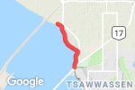
Breakwater PathGravel route from Tsawwassen Dr S to Unnamed Road, Greater Vancouver, British Columbia |

1 mi
gravel
Delta - South Surrey Regional GreenayGravel route from Fairlight Crescent to Colebrook Rd, Surrey, Greater Vancouver, British Columbia "smooth, good way to connect North Delta to Colebrook Rd and then onto King George" |

2 mi
gravel
Delta - South Surrey Regional Greenway Access TrailGravel route from Nordel Way to 64 Ave, Delta, Greater Vancouver, British Columbia "Rough and potholed, recommended to take the trail on the east side of the train tracks" |

1 mi
gravel
N Delta GreenwayGravel route from Santa Monica Dr to Blake Dr, Delta, Greater Vancouver, British Columbia "Smooth, best choice for getting from the Alex Fraser to 72nd Ave" |